Part 3 West Coast - Stanley to Sandy Cape
Saturday, 19 February 2022
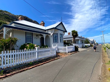
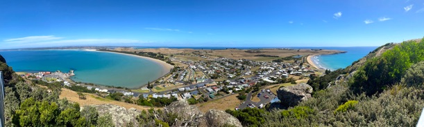
Stanley was perhaps one of the prettiest and interesting towns so far in Tasmania.
The houses like those on the left circa 1860’s, convict ruins, Highfield House - white history. and the scenery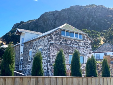 . - The Nut.
Building around the wharf area date back to 1835 and built of Blue Stone, which is recycled ships ballast from the early sailing ships.
This is the VDL’s Company store - VDL = Van Diemen's Land Company. Formed in the UK in 1825 with the idea of growing wool for the hungry UK market.
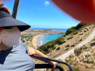
Lyn hates chair lifts - note how tight the left hand is !!
Not sure if Lyn actually opened her eyes to the great view.
We walked the 2kms around the top of ‘The Nut’ and spotted seals on the rocks below.
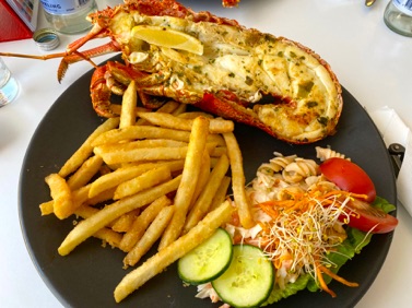
Lobster lunch at the local Hursey’s Seafood.
As a major crayfish port, this had to be on the menu.
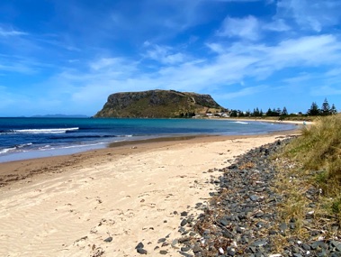
The Nut, actually the core of an extinct volcano is visible from quite some distance.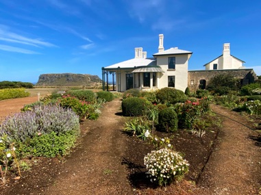
Highfield House was the headquarters of the Van Diemen's Land Company.
Established in 1827, it was one of colonial expansion, commercial opportunism, and cultural arrogance, it was also about extraordinary human endeavour, and courage in the face of the unknown.
They were granted a vast area of land and a number of convicts, but bitter conflicts continually existed between the government of the day and the VDL Company.
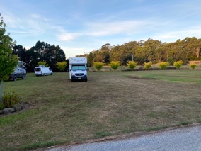
Free Camp No 12.
Tall Timbers Free camp ground..
WHY when there is 20 acres of open country do people park on top of you ???>
Today 45 Kms
Total 1200 Kms
Sunday 20th February 2022
Into the Tarkine Forest of Myrtle Beech with an under story of huge treeferns.
These Beech trees can grow up to 50m and in excess of 500years.
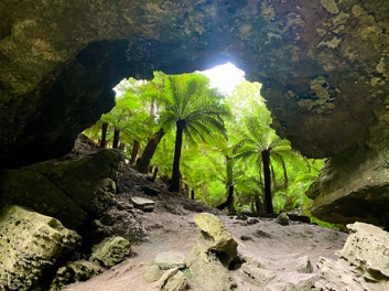
Here at the Trowutta Caves is a natural arch that has formed where two sink holes collapsed.
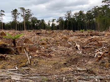
Then forestry tracks towards the west coast. We come across this rape clearing in preparation of one crop gum tree plantings ??
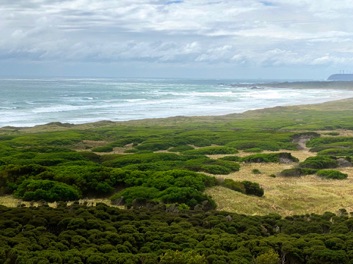
The Wild West Coast.
We came to see the Preminghana Indigenous protected area.
....Disappointing
Run down, signs missing, no information. The only real signs were numerous red ‘NO ENTRY’ signs on every side road.

The weather is bleak, cold and scattered showers.
The sea wild ..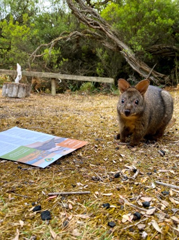
Camp No 13. Nat Parks $15 for 2
Manuka Camp Ground - Arthur River.
....and the local Padymelon came to share pre-dinner drinks
Today 155 Kms
Total 1245 Kms
Monday 21st February 2022
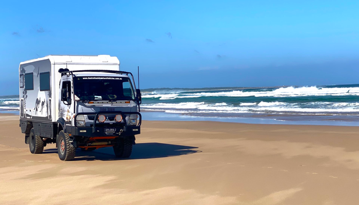
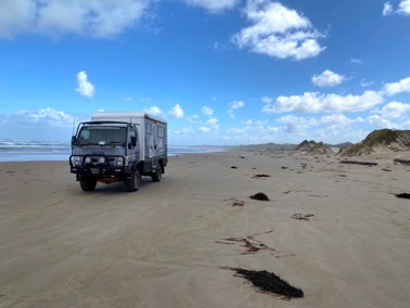
We now have permits to drive the 4x4 tracks and beach down to Sandy Cape. Its one of those must do 4x4 adventurers in Australia.
Permits $30 for 1 month and includes camping permits..good value
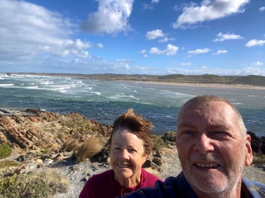
First stop is the “Edge of the World” lookout point just south of Port Arthur.
...YES windy
After receiving all the WARNINGS from the National Parks office - ‘quicksand, drowned vehicles, etc, etc’
I was ready top go, Lyn was apprehensive !
This is a beach between Arthur River and Temma - just a test run
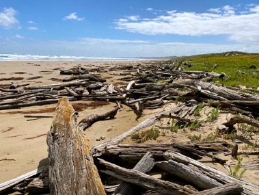
This end of the beach is beautiful and full of Huon Pine logs washed down the Arthur and Franklin River system.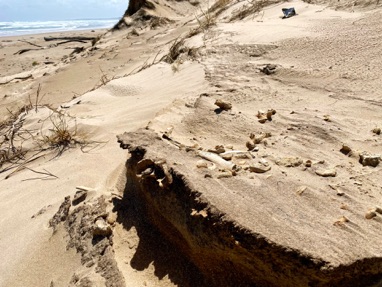
The west coast has been inhabited for millennia and all along the coast are middens of shells and in this case bone fragments.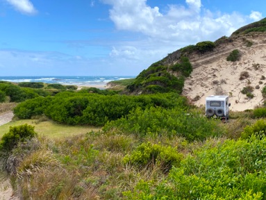
I asked about the tide times and the response was they are more Barometric than Lunar.
Thus wind direction is critical
Anything over 4m is a bit challenging
Wild Camp No 14.
Tiger River just off the beach.
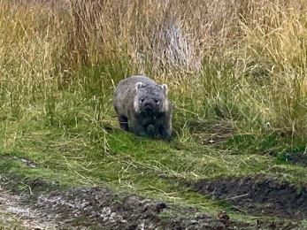
Padymeloms and a wombat walk by the camp
Today 30 Kms
Total 1275 Kms
Tuesday 22nd February 2022
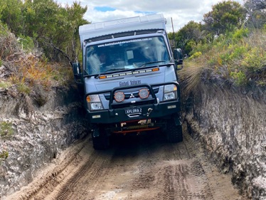
These trucks are build the same width as the tray on a LandCruiser / LandRover-
This is why !!
The tracks are narrow and we have to watch for low trees.
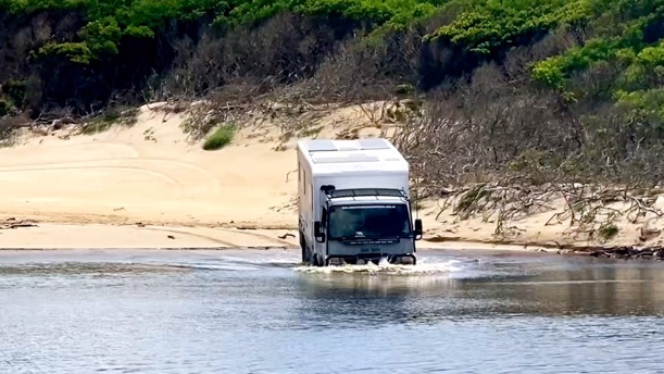
Brook Creek we were warned about so I walked it twice and even convinced Lyn to walk across with me to video from the other side.
The water is just at crotch depth at the deepest part.
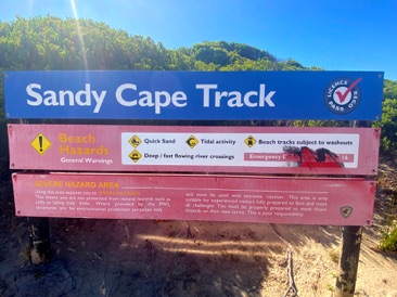
The warning sign before the beach
QUICK SAND; TIDAL ACTIVITY; BEACH TRACKS SUBJECT TO WASHOUTS; DEEP AND FAST FLOWING CREEKS........
This is the most challenging part , the 8km beach run, because where the streams enters the ocean there is the quick sand so one has to drive close to the wet sand on the ocean side.
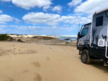
We have an incoming tide so even that was soft.
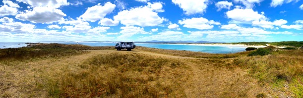
This is Sandy Cape, with the beach run stretching in the big curve back behind us.
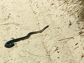
Whilst looking for a camp site this, this 2m Tiger Snake on the track.
Wild Camp No 15.
Sandy Cape back in the open country away from the wind
Did some long walks to check out a camp for tomorrow night.
A couple of wombats walk by the camp
Today 49 Kms
Total 1327 Kms
Here we are
Wednesday 23rd February 2022
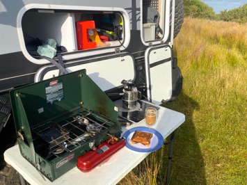
The day starts with jaffels
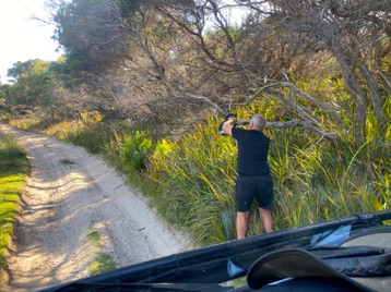
A bit of high branch clearing to get back to the beach.
The battery chain saw is great addition.
We drive partly down the beach to Pedder Creek ( Yes the same river that starts in Lake Pedder)
There is a camp site in behind the dunes but the tracks are steep - soft dry sand and tight bush.
Just not sensible to push into this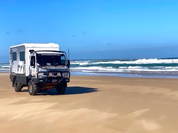
Most of the beach is easy wet sand driving...BUT....
We hit one patch of wet sand that was soft and full of air.
It was like driving across meringue.
Down 2 gears, missed the last one, stalled in the soft stuff.
A quick into LOW 4x4 and reversed about 1/2 metre then a quick succession of 1,2,3 & 4 in low to keep us moving.
Was the heart pounding...YES
Found this really great camp site, Blue Sky, Turquoise water, Wind had dropped, Quite and Peaceful.

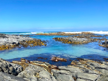
We are staying here because,
this is our view.
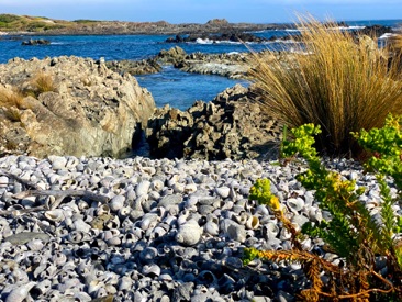
Spent the day walking the bays north and south of camp.
Discovered lots of middens but this one definitely the largest.
Just thick with shells incl abalone
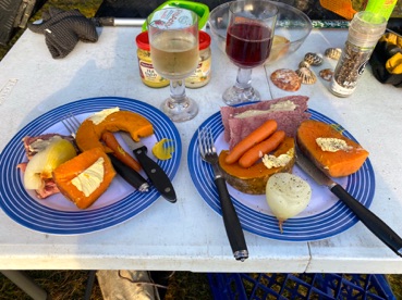
Dinner menu:
Pre dinner drinks
Silverside with vegetables
Both red and white wine
Plum pudding and custard
A glass of port, as we watched the sun set over the Southern Ocean as it heads towards Argentina.
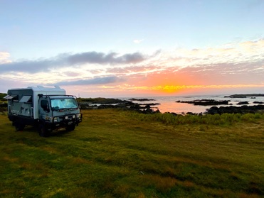
Wild camp 16 & 17
This is where we are:
Tomorrow the Balfour track...